
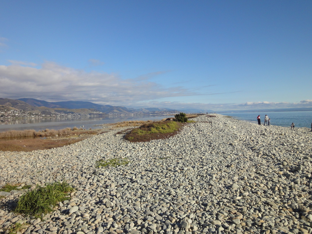
Boulder Bank
|
NGR
Age
Description
Explanation
Access
Further information
|
1630261, 5440042
Recent (<6000 yrs BP)
A 13 km coastal spit, made up of pebbles of (mainly) granodiorite, showing size and shape sorting from east to west.
The spit has formed as a result of longshore drift, carrying material in a southwestward direction, over the last 6000 years. The immediate source of the material appears to be older gravel banks, further offshore. The ultimate origin of the materials, however, is the Cable granodiorites that crop out on Mackay Bluff, near the morth-east end of the spit. The gravels become rounder and finer to the west, due to abrasion and sorting during transport.
Easily accessible from the carpark and footpaths in The Glen - ca. 3km north of SH6.
|
Magazine Point
|
NGR
Age
Description
Explanation
Access
Further information
|
1621413, 5430544
Oligocene/Pliocene
Good exposures of Tertiary sedimentary bed (alternating sequences of mudstones and sandstones, with rare conlomerates), showing clear bedding and dip, and minor structural features (joints). Location of first recorded fossil in NZ.
Sediments have been laid down in a shallow marine environment. Deposits show evidence of gravity flows, debris flows and storm-redepodited sandstones. The exposures are in araised, wave-cut platform.
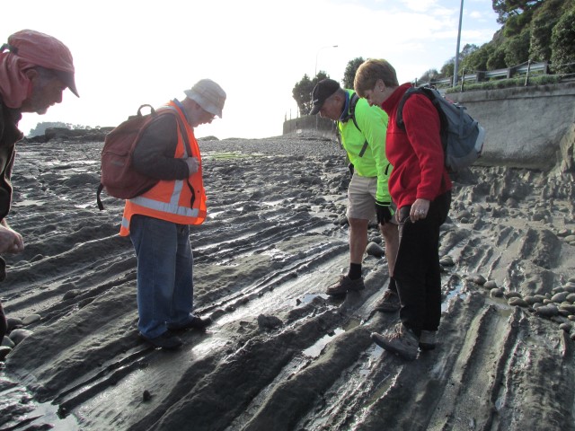
Easily accessible from beach and sea-front footpath (Rocks Road) at low tide. Cliff sections are easily visible, but access is limited by security fences, and care is needed due to road traffic and risks of falling debris.
|
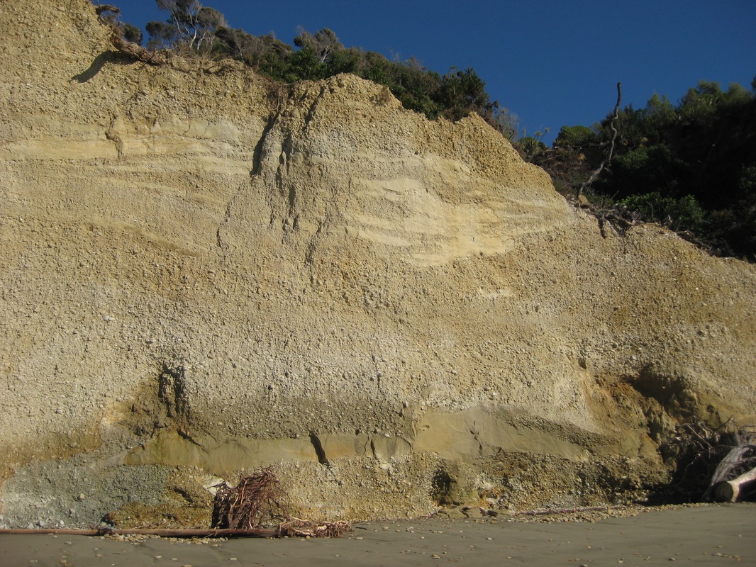
Kina Cliffs
|
NGR
Age
Description
Explanation
Access
Further information
|
1615317, 5441128
Pliocene, Pleistocene
Excellent exposures of deep gravel deposits (Moutere Gravels) in high, marine-cut cliffs, showing clear channel features and occasional fossil trees. Wave-cut platform visible beneath beach deposits at low tide.
Gravels were laid down as flysch-like deposits by streams draining the rising Alpine range during Pliocene and early Pleistocene times. Exposure show evidence of braided gravel-bed streams, with occasional cross-bedding, fining-upward cycles, sand and silt-filled channel-cut features, floodplain deposits and occasional stumps and trunks of trees (Nortofagus).
Easily accessible from beach at all but high tide, but extreme care is needed due to risk of falling debris. DO NOT APPROACH THE BASE OF THE CLIFF.
|
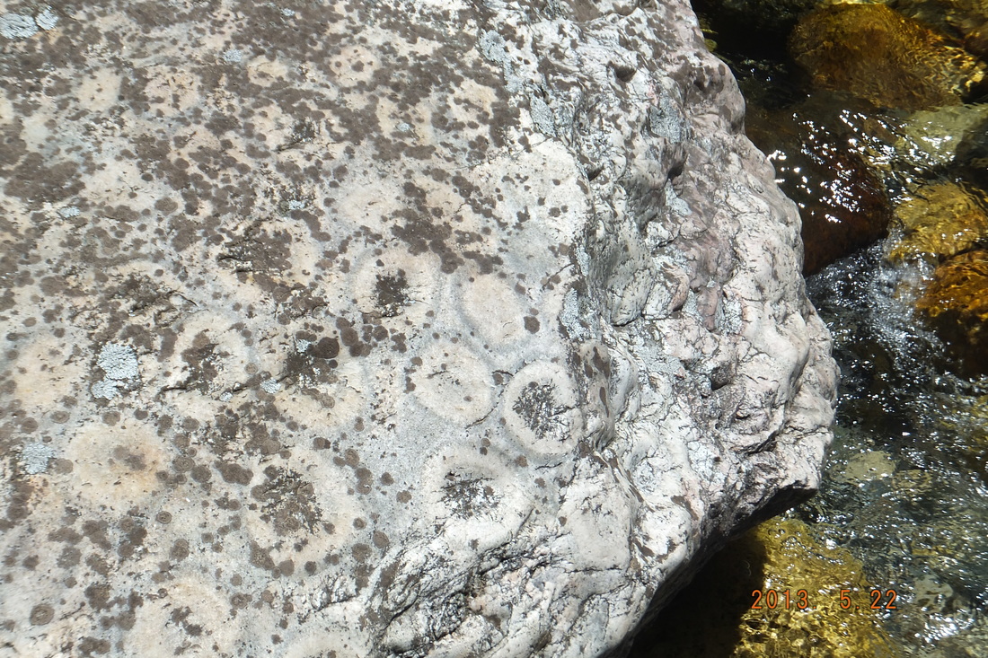
Split Apple Rock
|
NGR
Age
Description
Explanation
Access
Further information
|
1601616, 5459297
Cretaceous
A spectacular boulder of granite, split in two by weathering, in the shape of an apple. Sections in granite show weathering features. Small areas also visible of rare orbicular granite.
Granites were intruded during the Cretaceous, and form part of the Separation Point Suite. The majority of the exposed granites are biotite gramites, showing large crystals of feldspar. The orbicular granites are localised and easily recognisable by their golf-ball sized spheres of concentrically-layered rock; formation is supposedly due to nucleation of cooling magma around a solid grain.
Split Apple Rock can be viewed at all times from beach (at end of short footpath); access to granite sections possible at low-mid tide; orbicular granites accessible only at low tide.
|
Takaka Hill Limestone
|
NGR
Age
Description
Explanation
Access
Further information
|
1688900, 5457850
Ordovician
The most extensive and accessible marble formation in New Zealand, showing interesting karst features. Fossils include crinoids, corals, bryozoa and rare brachiopods.
Limestones deposited in shallow marine waters during the Ordivician have been lightly metamorphosed to form the Mount Arthur Marble, of variable quality. Subsequent solution (Pleistocene and Recent) has created a range of karstic features including sinkholes and cave systems.
Accessible from various locations along the Takaka Hill road, including the Lookout Walkway, Takaka Hill Walkway and Canaan Road and Harwoods Hole track.
|